

NASA astronaut Chris Williams captures Bahamas sandbar waves from 263 miles above Earth
A summertime ISS snapshot turns into a reminder: we can still see beauty and physics clearly, even from space.
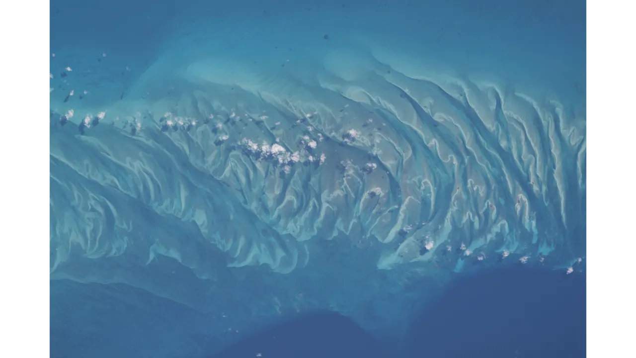
NASA astronaut Chris Williams took a photo from aboard the International Space Station of turquoise waters and rippling sand dunes off Eleuthera in the Bahamas. The image was captured 263 miles (423 kilometers) above the Atlantic, showing how planetary-scale views shape how decision-makers think about Earth and beyond.
NASA astronaut Chris Williams just shared a picture that looks like a travel ad, but it was taken 263 miles (423 kilometers) above Earth. From aboard the International Space Station, he photographed turquoise water off the coast of the island Eleuthera in the Bahamas, where rippling sand dunes and sandbars peek up beneath the ocean like a hidden shoreline pattern. If you stare long enough, the scene almost tricks your brain into “hearing” the waves or imagining a salty breeze. But the real takeaway for everyone watching from Earth is more precise than mood: the image is a demonstration of what our instruments can resolve from orbit.
The moment was captured from the ISS orbiting Earth’s Atlantic Ocean, and the geometry matters. At 263 miles up, the Bahamas are not a postcard detail, they are a planetary surface feature. The photo shows crests of waves of sand, exposing how coastal dynamics can create visible textures that stand out even from space. That “visible from far away” quality is exactly why images like this matter to executives and boards, even when the content looks purely aesthetic. It is a proof point for how remote sensing turns environmental surface signals into something legible at scale.
And Williams did not only bring a camera to space. The source notes it is not the first fun snapshot from him, and it references that he recently captured another photo mid-spacewalk. That detail is small but telling: astronauts are trained to execute missions with strict safety and procedure, yet they also capture moments that translate complex operations into understandable visuals. For decision-makers, that matters because communication is part of the mission. When the people doing the work can share clear images, it improves internal alignment, public trust, and stakeholder engagement. Space programs compete for attention and continuity. Strong visuals are one of the tools that helps keep that continuity alive.
So what is actually in this image? The source describes sandbars and rippling sand dunes among turquoise ocean waters in the Bahamas. It places the scene specifically off the coast of Eleuthera. The crests of rippling waves of sand appear beneath the water, which suggests a coastal zone where sediment motion and wave energy combine into repeating patterns. The result is the kind of high-contrast texture that is ideal for observation from orbit. From 263 miles away, the contrast between sand and water becomes a map-like signal, turning a shoreline into something that can be tracked, compared, and studied over time.
Here is the second-order implication that executives should not ignore: the source explicitly frames the photo as more than pretty. It argues that the image is a reminder that Earth is truly special and that, in the future, missions could see beauty like this from space on a far off exoplanet or even a planet outside our solar system. Today, the only place with views like this is our planet, but the path from “we can see it here” to “we can infer it there” is the larger business and science ladder. When you invest in space exploration, you are not only funding rockets. You are funding the methods for interpreting distant worlds through remote observation.
That is why a calm shoreline matters to a room full of CFOs and strategy leads. The same capability that lets the ISS capture a turquoise coastal feature at 263 miles also supports broader Earth observation and, eventually, exoplanet science by sharpening how we think about planetary appearance from afar. Remote imaging has to resolve signal, separate noise, and translate pixels into meaning. Even when a story is framed as “summer snapshot,” the operational reality underneath is about measurement. And measurement is how boards de-risk technology programs. It is how regulators and oversight bodies can justify funding by pointing to observable outcomes, even before long-term scientific returns fully land.
To be clear, this particular article is not about a regulation change, a policy filing, or a new launch contract. It is about a photo. But the governance ecosystem around space is still present in the background. ISS operations and astronaut activity sit within highly controlled constraints, which is why the ISS can produce consistent images that stakeholders can trust. In other words, the “captured 263 miles above Earth” line is not just a trivia fact. It is a credibility anchor. Consistency and traceability are what make remote imagery valuable in serious contexts.
The strategic stakes are simple. Organizations that track Earth from space, or plan for the next generation of missions beyond Earth, need to show two things at once: capability and consequence. Capability means we can take and interpret images from orbit. Consequence means those images can inform how we understand our planet and what we might look for elsewhere. This Bahamas scene is a reminder that the most human part of science, wonder, is also the most legible part of science communication. And for leaders in space-adjacent roles, that can be the difference between a program that stays visible and one that gets quietly deprioritized.
This story's Key Insights and Take-aways are locked.
Create a free account to unlock Executive Actions for one credit.
Register to UnlockAlways free for Executives Club members. Join the Club
More in Science
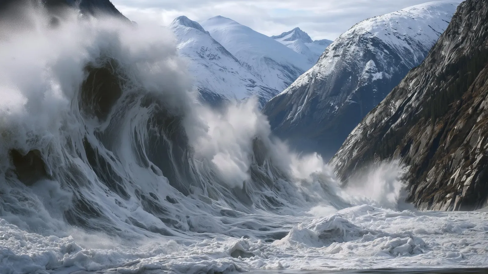
Alaska's 1,580-foot tsunami had warning signs. Scientists just found them.
Rapid glacier retreat, heavy rainfall, and thousands of tiny tremors preceded Alaska's 1,580-foot tsunami, a warning for every coastal community in a warming world.

The rare mutation that lets high-risk brains dodge Alzheimer's
Scientists found a natural defense against protein buildup, opening a new path to preventive treatments.

3,000 steps a day may halve Alzheimer's decline, study finds
New research links a modest daily walk to less tau buildup and nearly half the cognitive and functional decline, even for those with early signs.