
FireSat launches July 7, 2026, after $15M Google backing aims to catch smaller wildfires
Three operational satellites are entering orbit to deliver faster, more sensitive fire detection to agencies worldwide.
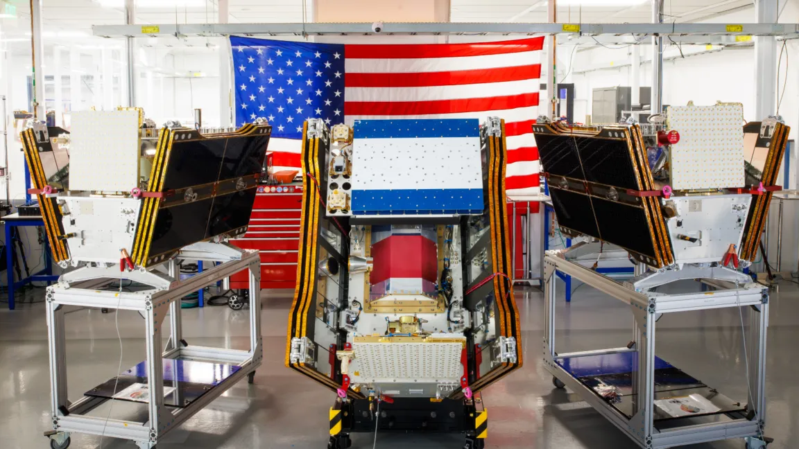
Google-backed FireSat launched its first three operational satellites into orbit on July 7, 2026 aboard a SpaceX Falcon 9 from Vandenberg. Decision-makers in climate risk, public safety, and defense-adjacent sensing now get a purpose-built wildfire monitoring stack moving toward initial operational capability.
Smoke from hundreds of wildfires has been choking both Canada and the United States, and on July 7, 2026, that messy reality got a new sensor layer. FireSat, the Google-backed wildfire detection program, successfully launched its first three operational satellites into orbit.
These satellites are designed to find wildfires that other satellites can miss, including smaller fires. After a three-month testing period, FireSat will begin actively providing data to fire agencies and cover every fire-prone region on Earth at least twice per day, with the goal of delivering wildfire detection across the United States, Australia, and Europe before the end of the year.
Zoom out for a second and you see why this matters. Satellite wildfire detection is already a crowded field, but the Achilles heel is resolution and sensitivity when fires are small, intermittent, or obscured by smoke, clouds, or terrain. FireSat’s pitch is that it is purpose-built for detecting wildfires, rather than repurposed hardware meant for other tasks. That design choice is the entire strategy: if you can catch the beginning of a fire, you can compress the time window for response. Faster detection can mean fewer acres burned, more effective allocation of crews, and better situational awareness for decision-makers who are constantly trading speed against uncertainty.
The launch itself is not just a science milestone, it is a governance milestone. FireSat’s “initial operational capability” transition is managed by the nonprofit Earth Fire Alliance. The program also involves California-based satellite manufacturer Muon Space, which designed the satellites. That mix, a nonprofit operations manager plus a commercial manufacturing partner plus a big tech funder, is a recognizable pattern in modern climate tech. It is built to reduce time-to-fielding while trying to keep the mission aligned with public outcomes, not only product metrics.
Money is the other lever, and the numbers matter. The satellites have received over $15 million from Google to support initial deployment. Another major funder is the Bezos Earth Fund, which committed $26 million. For executives and boards watching climate and sensing ecosystems, this is a signal that high-stakes monitoring is moving from “nice-to-have research” toward “mission-critical infrastructure.” Once a constellation is in orbit, the question shifts from whether it works in a demo to whether it is operationally reliable, has stable data pipelines, and can be trusted by agencies during peak fire season when every minute counts.
Operationally, the timeline is tight. The three microsatellites launched aboard a SpaceX Falcon 9 from Vandenberg Space Force Base in California, and then they enter a three-month testing period. After that, they will begin actively providing data to fire agencies. The ambition is global coverage at a specific cadence, at least twice per day across every fire-prone region on Earth. That matters because wildfire monitoring is not a one-and-done lookup. It is continuous intelligence, used for everything from dispatch decisions to coordinating resources across jurisdictions.
There is also a procurement and regulatory implication hiding in plain sight. Wildfire detection is typically entangled with government requirements and public safety workflows, where adoption depends on repeatability, transparency, and operational cadence. FireSat is moving toward active data provision to fire agencies, which suggests it is aiming to integrate into existing incident response ecosystems rather than staying as a standalone dataset. For decision-makers in emergency management, environmental monitoring, and risk analytics, that means the competitive landscape is about to get sharper. A constellation purpose-built for wildfire detection, backed by large-scale funding and progressing to initial operational capability, increases the odds that agencies will evaluate it alongside current solutions.
And for peers in similar roles, the strategic stakes are bigger than satellite schedules. If FireSat delivers on the promise of spotting smaller fires, it effectively shifts the odds in early-stage firefighting. That can ripple into budgets, staffing models, insurance and underwriting assumptions, and even how governments structure prevention programs. The launch is the visible event. The real change is the potential to tighten the detection-to-response loop across the US, Australia, and Europe, before the end of the year, starting with the first operational satellites and ramping through a constellation designed to cover the planet’s most fire-prone regions.
This story's Key Insights and Take-aways are locked.
Create a free account to unlock Executive Actions for one credit.
Register to UnlockAlways free for Executives Club members. Join the Club
More in Business

Uber buys Delivery Hero for nearly $15B, vaulting to top food delivery outside China
The deal doubles Uber's dual-services footprint and pushes a ride-and-eats bundling play into 50 more markets.

Epic and Google drop settlement bid, forcing rival Android app stores by July 22
Google told the court it is ready to carry third-party app stores starting Wednesday, July 22.

SK Hynix opens at $170, raises $26.5B, and tops foreign IPO records
In Friday's Wall Street debut, SK Hynix turns AI RAM demand into a $26.5B fundraising moment that rewrites comps.