
El Niño Woke the Atacama's Dormant Seeds. Satellites Caught the Biggest Bloom Yet.
A wet winter and rare August snow triggered what researchers call the most significant 'flowering desert' since remote sensing began, a live test of Chile's land-use and climate-risk assumptions.
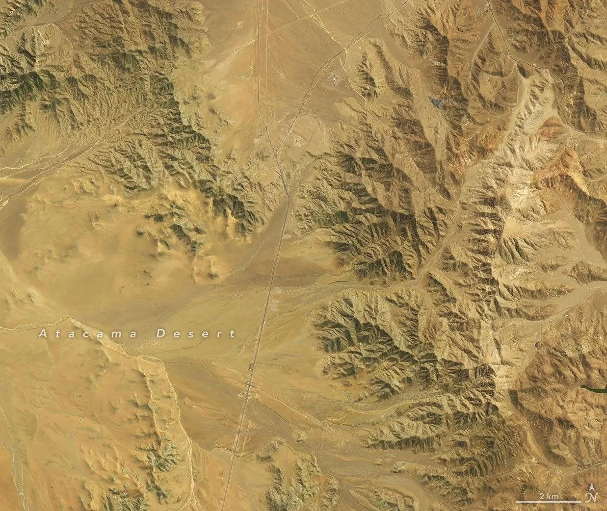
El Niño-driven rains and rare August snow woke dormant seeds across northern Chile's Atacama Desert, producing what researchers including Andres Moreira-Muñoz of Pontificia Universidad Católica de Valparaíso call the most significant 'flowering desert' of the satellite era. For executives, the event is a benchmark for El Niño exposure and a preview of how satellite-derived biodiversity data will feed land-use, conservation, and physical-risk decisions.
One of the driest places on Earth just staged a comeback that satellites have never recorded at this scale. Parts of the Atacama Desert in northern Chile turned red-purple, green, and white in austral spring 2026 after an unusually wet winter, and the rain woke seeds that had been sitting dormant in the soil. The result is a desierto florido, or "flowering desert," that scientists say may be the most extensive of the satellite era. "This instance of the 'blooming desert' phenomenon appears to be the most significant to date-in terms of its extent, intensity, and duration," said Andres Moreira-Muñoz, a scientist at Pontificia Universidad Católica de Valparaíso who studies plant geography, "at least since we began using remote sensing." That is the headline number here: not a dollar figure, but a record. And it arrived on the back of a climate pattern that touches food, water, mining, and insurance far beyond Chile's borders.
The setup was El Niño, strengthening in the tropical Pacific. During an El Niño, the subtropical Pacific high that normally keeps the region dry weakens, while a blocking high tends to form in the South Pacific near the tip of South America. Together, those shifts push the Southern Hemisphere storm track equatorward. Beginning in mid-July, a series of storm fronts fed by an atmospheric river delivered one of the heaviest July rain events in decades to a long stretch of Chile, from the Atacama region south to Los Lagos, according to Chile's national weather service, the Dirección Meteorológica de Chile. Then, in August, back-to-back winter storms blanketed parts of the Atacama in rare snow. Wet, then cold, then warm: the sequence that dormant seeds had been waiting for.
The proof is in paired satellite images. The OLI instrument on Landsat 8 captured the September 14 scenes; the OLI on Landsat 9 captured October 24. One pair shows a stretch of desert about 30 kilometers (20 miles) southwest of Copiapó, near the eastern sector of Desierto Florido National Park. The red-purple wash that dominates the October frame is a vast bloom of pata de guanaco, most likely Cistanthe longiscapa or another Cistanthe species, according to Roberto Chávez, a remote sensing scientist at the same university. A second pair, roughly 50 kilometers (30 miles) southwest of Copiapó, sits inside a priority area cited for its biological significance, including the flowering landscape. There, the September scene reveals green hillsides capped with white: blooms of suspiros, or Nolana, probably Nolana baccata, per Moreira-Muñoz.
Chávez and colleagues were on the ground the same day the October image was taken, photographing the Cistanthe blooms and collecting satellite data, drone imagery, and digital camera shots. The project, funded through Fondecyt Regular Project 1251184 from ANID in Chile, aims to map how the bloom's biodiversity changes across space and over time, with the explicit goal of informing land-use planners and conservation managers. That is the part worth underlining for anyone who thinks of this as a pretty picture. The bloom is being converted into a dataset, and the dataset is meant to shape decisions. The historical baseline is already deep: a 2014 study used Landsat observations to map where flowering and fog-fed plants grow around the Copiapó dune field, and a 2019 study used NASA's long-term vegetation record to identify 13 Atacama blooms between 1981 and 2015. Against that record, 2026 stands apart.
Why should a board in Santiago, San Francisco, or Singapore care about wildflowers in a hyper-arid desert? Because the Atacama is not empty. It is the operating backdrop for major mining, energy, and water infrastructure, and Chile has spent years formalizing protections around this exact landscape, creating the Desierto Florido National Park by decree in 2023. A bloom of record extent is a live test of how those boundaries, water rights, and land-use plans hold up when the climate delivers an outlier. It is also a reminder that El Niño is a global repricing event, not a regional weather story. The same ocean-atmosphere shift that soaked northern Chile typically reshapes rainfall, crop yields, hydropower output, and commodity flows across multiple continents. The bloom is the visible, photogenic edge of a system that moves real money.
There is a second-order story here about the instruments themselves. The September and October images come from two different Landsat satellites, built and launched years apart, working as a single continuous record. That continuity is the asset. It is what let researchers in 2019 count 13 blooms across 34 years, and it is what lets them now say with confidence that 2026 is different. NASA Earth Observatory produced the imagery using Landsat data from the U.S. Geological Survey, and the photographs came from Matías Pérez-Evens and Roberto O. Chávez at LabGRS-Instituto de Geografía at the university. Open, long-running Earth observation is quietly becoming core infrastructure for insurers, lenders, and regulators who need to price physical risk. Stories like this one are the proof of concept.
The strategic stakes for peers are straightforward. First, treat the 2026 bloom as a benchmark, not a novelty; the next El Niño will be measured against it. Second, watch what the mapping project produces, because biodiversity data that informs land-use planning eventually informs permitting, conservation finance, and reputational risk. Third, remember the bloom is ephemeral, as these events historically are. The rains that woke the seeds also brought flooding and rare snow, and the color will fade. What persists is the record, and the record is now telling a story about extremes that are getting easier to see and harder to dismiss.
This story's Key Insights and Take-aways are locked.
Create a free account to unlock Executive Actions for one credit.
Register to UnlockAlways free for Executives Club members. Join the Club
More in Science

Anthropic's I.P.O. Made Rank-and-File Researchers Worth Tens of Millions
Researchers who joined just a few years ago are now worth tens of millions, and the windfall resets the pay benchmark for every private A.I. lab still paying in paper.

Sea Lion Culling Strategy Fails: New Model Says Killing Them Won't Save Salmon
The latest research from AAAS overturn a long-held conservation assumption, forcing policymakers to rethink critical resource allocation in marine ecosystems.

Microplastics do more than pile up: they react with water to damage cells
Scientists have found that plastic particles can generate highly reactive molecules in water, a mechanism that could explain links to heart attacks, strokes, and neurological disorders.